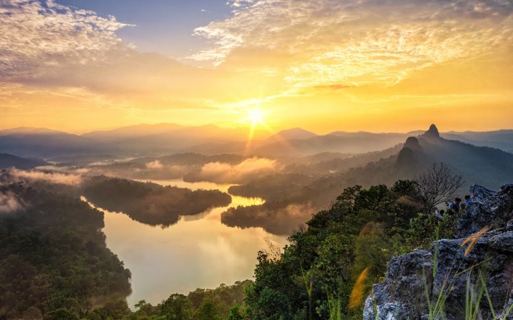
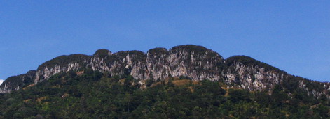
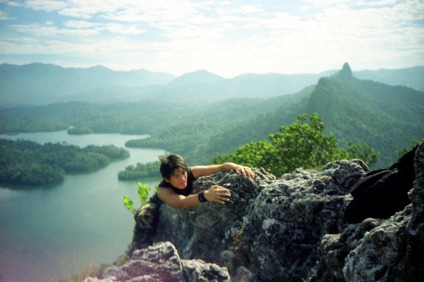
Bukit Tabur is a hill located in Selangor, Malaysia. It is also known locally as Bukit Hangus. The hill is very prominent as it is part of Klang Gates Quartz Ridge and can be seen from the Kuala Lumpur Middle Ring Road 2. The hill, which is less than 500 metres, is a quartz ridge. Bukit Tabur has world’s longest quartz ridge. Climbers enter the hiking trail via Kampung Klang Gates, 50 metres from the gates of the Klang Gates Dam, at the back of Taman Melawati for a 3-4 hour climb. The Gombak Forest Reserve and Klang Gates Dam are beside the hill. The peak offers view of the dam and panoramic views of Kuala Lumpur from the north. Several endemic species of plant such as Aleisanthia rupestris are known to grow here.
The hiking trail to Bukit Tabur can be found at 3°14′1″N 101°44′55″E.
Bukit Tabur is divided into the eastern and western section by the dam. Most hikers are familiar with the western section. The eastern side offers more challenging hikes but is said to be steeper and riskier if unfamiliar with the trail.
There has been a series of accidents on the trail including several fatal mishaps. It is likely that more restrictions will be imposed on hikers on this trail.
Location
Taman Melawati, 20mins drive from center of Kuala Lumpur
Taman Melawati, 20mins drive from center of Kuala Lumpur
How to get there
The drive path to the Start Point is very tricky, use the google map or google earth to get the direction with following GPS position information.
The drive path to the Start Point is very tricky, use the google map or google earth to get the direction with following GPS position information.
Entrance from the main road
Latitude : 3°12’58.67″N
Longitude: 101°44’18.61″E
Latitude : 3°12’58.67″N
Longitude: 101°44’18.61″E
Entrance, starting point
Latitude : 3°14’1.90″N
Longitude: 101°44’56.65″E
Latitude : 3°14’1.90″N
Longitude: 101°44’56.65″E
Park your car at the roadside soil road near the Klang Gate Dam, make sure your car wont block the access road. look for the short cement wall where the trail begins in an old orchard,the path going up the hill is pretty straightforward by follow the trail.
How do i return at the end or half way
The return path is very tricky, there are 2ways to return back to the Start Point.
The return path is very tricky, there are 2ways to return back to the Start Point.
- The straightforward, just follow the same path where you came from.
- Another exit path is tricky as there is no signboard, you will have to go until the end of the trail and there is a downward trail that will lead you down to the jungle trail. Please be cautions, finding the right trail is tricky, friend of mine has got lost in the jungle from chosen the wrong trail. For first time visitor, i will advice to take path of where you came from, otherwise meet others visitor there and follow them.
Duration
Conservatively 1.30hr up to summit from start point, 1.30hr down
Conservatively 1.30hr up to summit from start point, 1.30hr down
Best time to start hike
7am to 8am, for those wanted to cache sunrise should start hike at 6:30am or early, weekend especially at Sunday is very pack.
7am to 8am, for those wanted to cache sunrise should start hike at 6:30am or early, weekend especially at Sunday is very pack.
Climate
dry season is best time to visit, dry season falls between Feb-Aug.
Difficulty: climbing staircase efforts, however if you have medical and physiological limitations must first obtain approval from the doctor prior to the hike
dry season is best time to visit, dry season falls between Feb-Aug.
Difficulty: climbing staircase efforts, however if you have medical and physiological limitations must first obtain approval from the doctor prior to the hike
Height
approximately 1000m
approximately 1000m
What to Wear
Casual clothing with light weight trekking or jogging shoes. shoe must not be tight and able to walk for long hours without pain.
Casual clothing with light weight trekking or jogging shoes. shoe must not be tight and able to walk for long hours without pain.
What to bring:
- Change of clothes and towel
- Sun block(Optional)
- Min. 1.0 liter of water per person
- Slippers (optional, for backup purpose)
- Waterproof camera (optional), Snack food (optional)
- First-aid-kit
- Rain coat (optional, very rare rain in the morning in dry season)


No comments:
Post a Comment